Part 1
Highway 33 – 7-Mile Road – Soda Road
Wednesday, April 10

After a very hectic couple of weeks prior to leaving, we managed to get out of San Francisco and down to the Carrizo Plain to start our two month road trip. As usual, we faced a few RV issues both before and after we left. Toilet and hot water heater problems. Once on the road, those things faded away and we were left with driving and making photographs.

It took us a couple of days to get to Carrizo. First we camped at San Luis Reservoir SRA at the Los Banos campground which was a nightmare to find as Garmin took us to a completely different campground on the wrong side of Interstate 5. When we finally pulled in, our nice site by the lake was in reality, half IN the lake. Fortunately we could change sites and ended up in a nicer spot.

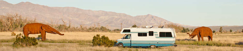
The next day, we moved on to Tupman, where we set ourselves up in the Buena Vista Aquatic Recreational Area for the next four days. We want to do both the east and westside roads, and this location will be good for giving us the choice of starting from either end of the monument.

This week was a nice weather window we were well positioned to take advantage of. Rain during the prior weeks had left the dirt roads impassable for a time, but they were now well dried out. With the upcoming weekend promising more rain, we managed a good couple of days in the monument between storms.

We set-out at dawn on Wednesday. There was still a 50 mile drive from Tupman to 7-mile Road north entrance. Turning onto Highway 33, the road traversed oilfields for several miles until it began to rise into the mountains leading to Carrizo. We stopped often as the road rose and twisted through the hills that separate us from the monument. Our previous visit in 2019, this road was spectacular in its flower displays. I certainly wouldn’t call it disappointing this year, though some online have. The flower displays were far from “Super Bloom” levels, but, it is a wonderful drive in on a curvy, less traveled highway.


Most prevalent were large patches of Goldfield – tiny yellow flowers that can create massive displays of color. Also in abundance were Fiddleneck, Phacillia, Daisy’s and Owls Clover. It was a bit more work composing images. Many of the hillsides were just beginning to sprout color and I was left to imagine what it might otherwise be.


The hills themselves are still interesting and worth stopping for. Steep drop-offs with wonderfully massive oak and juniper trees were all set-off by the brilliant greens of new growth. Still, there was less stopping which made our arrival in the monument a little quicker.


Carrizo
There was almost no blooming visible when we first turned onto 7-mile road. I’d heard this northern portion suffered a hard freeze the previous week during the rain storms, resulting in lots of dead flowers. This was apparent as there was little color and a lot of brown.

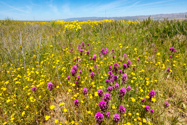
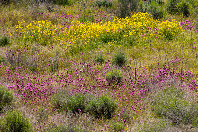
I wasn’t until we reached Soda Lake Road that we occasionally found some small to medium nice roadside displays. With just a little care with compositions, I could make it look much fuller.


Conditions changed as we drove further south. At Soda Lake, a short walking trail up a nearby hill led to panoramic views of a wide portion of the lake and plain. From up here, I could see how the hills around us were beginning to come to life again. I loved how the Temblor range of mountains reflected in the mirror smooth finish of the lake below. I made my favorite image of the day here.

Continuing on south, there were lots of stops now for nice little mixed displays of poppies, fiddle necks and various other flowers.


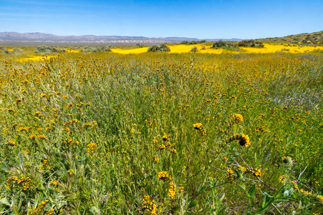
At the junction of Panorama Road, we could see a massively wide bloom of Goldfield across nearly the entire width of the plain. Despite the sign reading “Road Impassable” we had to go out there. As we got closer, I could see areas where cars may have been stuck – deep rutted and formerly muddy patches across the road. Now it was all dry and easily driven.

It is quite an experience standing in a field like this. Getting unique images was not easy and I don’t think I did. It’s just a mass of wildflowers, but who cares really. It’s fun just to be here.

The road looked to be in good enough shape to continue all the way across the plain to the more primitive Elkhorn Road, which travels north/south on the eastern side of Carrizo. I could see the old water troughs we drove by on an earlier trip down that road. We debated going across, but decided to stay with Soda Lake Road.

We returned to the main road and continued south. Flowers were definitely better in the southern portion, but still they tended to be spotty and there wasn’t a lot blooming on the surrounding hills either. It was looking like that might change in coming weeks. The new rain should help. I would have liked to explore some of the side roads more, but the day was getting long and fatigue setting in and we still had a bunch of driving to do. Not having any clouds was a bit disappointing. It really limits lighting possibilities to harsh overhead light.
We plan on doing Elkhorn tomorrow.

